OpenStreetMapはフリーで使える地図です。基本的にボランティアによる整備のため、データの確からしさというのは保証されていません。しかしながら、他では手に入りにくい情報などを取得できるため、活用できるのであれば活用したいところです。
OpenStreetMapのデータをダウンロードするには
本家でもExportすることは可能ですが、例えばアジア全域、日本全域、関東地方全域、などまとまってデータを取得したいことがあるかと思います。その場合は、ドイツのGeofabrik社のダウンロードサイトからダウンロードすることができます(こちらも参照してください)。
Geofabrik社のサイトにアクセスすると、いくつかのサブリージョンに別れたデータをダウンロードすることが可能です。ただ、Asiaだけでも12G以上のサイズとなっているため、さらに下位レベルのデータをダウンロードすることをおすすめします。最終的には関東、関西、というレベルでダウンロードが可能です。ちなみに、Asiaの中では日本は1.8Gとなっており最大サイズであり、中国の1Gよりも大きいサイズになっています。
データ自体は、Shape形式は、osm形式でダウンロードが可能です。osm形式はOpenStreetMap独自の形式で、利用できるソフトウェアも限られるかと思います(QGISでは対応しているようです)。今回はShape形式のファイルを見ていきたいと思います。
Shape形式のファイルを紐解く
関東地区のファイルをダウンロードすると、だいたい720Mくらいの圧縮ファイルが入手できると思います(解凍すると2.5Gくらいのサイズになります)。これを開くと、18個のShapeファイルが入手できます。
gis_osm_buildings_a_free_1.shp
gis_osm_landuse_a_free_1.shp
gis_osm_natural_a_free_1.shp
gis_osm_natural_free_1.shp
gis_osm_places_a_free_1.shp
gis_osm_places_free_1.shp
gis_osm_pofw_a_free_1.shp
gis_osm_pofw_free_1.shp
gis_osm_pois_a_free_1.shp
gis_osm_pois_free_1.shp
gis_osm_railways_free_1.shp
gis_osm_roads_free_1.shp
gis_osm_traffic_a_free_1.shp
gis_osm_traffic_free_1.shp
gis_osm_transport_a_free_1.shp
gis_osm_transport_free_1.shp
gis_osm_waterways_free_1.shp
gis_osm_water_a_free_1.shp
よく見ると、同じようなファイル名のファイルがあります。
gis_osm_places_a_free_1.shp
gis_osm_places_free_1.shp
aがついているか、いないかですが、よくよく見ていくと、どうやらPolygonなのかPointなのか、ということでファイルが分かれているようです。Shapeファイルは異なる形状の空間オブジェクトを格納できない(ポイント、ライン、ポリゴンを混在できない)ため、このようになっているようです。
- aがつく:Polygon
- aがつかない:Point
OpenStreetMapで使われているShapeファイルのフォーマットについて
Shapeファイルを開くと、以下のようなフォーマットになっています。
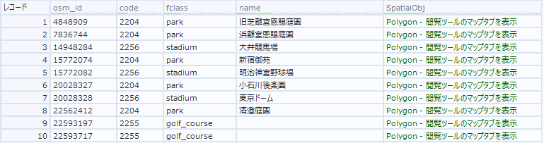
- osm_id
地物のIDです。
- code
fclassのコードです。
- fclass
codeに対してついている名称です。
- name
地物の名称です。
- SpatialObj
地物の空間オブジェクトのデータです。ポイント、ライン、ポリゴンのいずれかのデータが格納されています。
各ファイルの詳細
空間オブジェクトの形状をまとめると、12種類のファイルがあることがわかります。それぞれ詳しく見ていきましょう。
- gis_osm_buildings_a_free_1.shp
建物情報です。
fclass:building
- gis_osm_landuse_a_free_1.shp
土地利用区分のようなイメージです。農地、森、工業、草原、公園、居住地といったものがfclassで定義されています。
fclass:nature_reserve, cemetery, grass, industrial, vineyard, allotments, farmland, retail, meadow, heath, commercial, scrub, orchard, forest, farmyard, residential, park, recreation_ground, military, quarry
- gis_osm_natural_free_1.shp
自然物の名称が中心となります。有名な木、ビーチ、洞窟、崖といったものがfclassで定義されています。
fclass:spring, tree, peak, beach, volcano, cave_entrance, cliff
- gis_osm_places_free_1.shp
場所の名称、つまり行政の名称、島の名前などが格納されています。
fclass:village, farm, region, suburb, island, hamlet, national_capital, town, county, city, locality
- gis_osm_pofw_free_1.shp
宗教的なデータ、つまり寺院や教会などのデータが格納されています。
fclass:muslim, christian, christian_evangelical, hindu, sikh, christian_protestant, christian_methodist, christian_catholic, muslim_sunni, buddhist, christian_anglican, taoist, jewish
- gis_osm_pois_free_1.shp
商業施設などが格納されています。あまりにも様々なもの、他のカテゴリに属さないデータはすべて個々に格納されています。
fclass:kiosk, wayside_shrine, toy_shop, wayside_cross, newsagent, lighthouse, recycling_clothes, kindergarten, community_centre, greengrocer, garden_centre, hunting_stand, atm, department_store, artwork, biergarten, guesthouse, restaurant, beauty_shop, courthouse, track, caravan_site, town_hall, doctors, car_rental, shoe_shop, police, prison, recycling_glass, battlefield, attraction, tourist_info, furniture_shop, butcher, recycling_paper, market_place, water_well, recycling, laundry, bookshop, mobile_phone_shop, golf_course, vending_parking, castle, mall, travel_agent, cinema, observation_tower, water_works, car_dealership, theatre, clinic, video_shop, memorial, university, shelter, picnic_site, veterinary, nursing_home, pitch, motel, bicycle_rental, outdoor_shop, tower, bench, optician, water_tower, public_building, recycling_metal, supermarket, sports_centre, chalet, park, fountain, archaeological, windmill, vending_cigarette, nightclub, convenience, drinking_water, library, graveyard, hotel, beverages, theme_park, dog_park, florist, dentist, post_box, telephone, clothes, hostel, ice_rink, car_sharing, pharmacy, swimming_pool, hospital, camera_surveillance, post_office, general, food_court, embassy, pub, zoo, monument, alpine_hut, ruins, wastewater_plant, arts_centre, bakery, fast_food, museum, sports_shop, car_wash, hairdresser, comms_tower, stadium, water_mill, chemist, waste_basket, bank, playground, college, bicycle_shop, toilet, doityourself, cafe, stationery, fort, bar, gift_shop, viewpoint, vending_any, computer_shop, camp_site, vending_machine, jeweller, fire_station, school
- gis_osm_railways_free_1.shp
鉄道関連のデータが格納されています。
fclass:monorail, miniature_railway, tram, narrow_gauge, subway, light_rail, rail, funicular
- gis_osm_roads_free_1.shp
道路関係のデータが格納されています。
fclass:busway, unknown, motorway_link, cycleway, motorway, primary_link, track_grade4, trunk_link, track, track_grade3, steps, bridleway, secondary, trunk, footway, primary, living_street, unclassified, tertiary_link, tertiary, service, residential, secondary_link, track_grade2, pedestrian, track_grade1, path, track_grade5
- gis_osm_traffic_free_1.shp
交通関係のデータが格納されていますが、鉄道、道路以外のデータになります。駐車場など。
fclass:crossing, fuel, traffic_signals, parking_underground, parking, parking_multistorey, slipway, motorway_junction, marina, mini_roundabout, speed_camera, lock_gate, pier, weir, dam, waterfall, turning_circle, service, parking_bicycle, street_lamp, stop
- gis_osm_transport_free_1.shp
ここも交通関係のデータが格納されています。主に交通機関のデータが主となり、例えば空港、バス停、フェリーターミナル、鉄道駅、などです。
fclass:railway_halt, apron, bus_stop, bus_station, railway_station, airfield, tram_stop, helipad, airport, ferry_terminal, taxi
- gis_osm_waterways_free_1.shp
川や運河などのラインデータが格納されています。
fclass:drain, canal, river, stream
- gis_osm_water_a_free_1.shp
水域データが格納されています。ラインではなくポリゴンで表現されているデータです。
fclass:dock, water, reservoir, riverbank, wetland

コメント